Turkmenistan | Dehistan
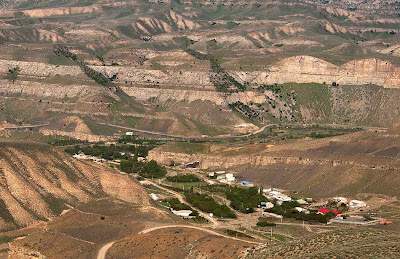
After our Visit To Nohur we continued west across the plateau of the Kopet Dag Mountains, finally dropping back down to the desert near the village of Kruzde.
Village of Kruzde (click on photos for enlargements).
Continuing on the main road west through the desert fronting the Kopet Dag Mountains we eventually arrived at a tiny town called Garaagas where we pulled into a truck-stop for lunch. If the old American saw that lots of tractor-trailer trucks in front of a diner indicated good food it looked like we were in for a treat. There were nine trucks, all but one with Iranian plates, in the parking lot. The Iranian border was less than five miles away, although the actual border crossing was about forty miles to the west. This may be the first truck stop in Turkmenistan after crossing the border. Actually there were only two drivers in the diner. The rest were apparently sleeping in their trucks. There were two tables with chairs and two low tables on platforms equipped with pillows so you could stretch out and relax while you ate. The cook, a saucy looking woman in her twenties, took your order at a window opening into the kitchen. She must take a lot of guff from the clientele in a place like this, but she appeared fully capable of taking care of herself. She announced that the only thing on the menu was fish, fried. It seemed a bit odd to have fish out here in the middle of the desert, but my driver reminded me that we were only about seventy-five miles from the Caspian Sea. He assured me the fish was fresh and had never been frozen. The fish were probably dropped off here every couple days by dealers plying the highway between the sea and Ashgabat. With the fish we had cabbage slaw, fresh naan (flat bread), and green tea. The fish was white, flaky, not too bony, and delicious. The tea wasn’t fit to slop down hogs (perhaps in part because of the local water) but hey, this was a truck stop. The truckers, I noticed, were drinking Nescafe, probably for its more pronounced caffein buzz (it also disguises the taste of bad water better than tea).
Just beyond Garaagas we turned off on a gravel road and headed west-northwest through the desert. Soon we stopped. It was time for my driver’s afternoon prayers. Rolling his prayer mat out on the sand, he performed the appropriate prostrations and orisons while I examined the flora of the desert.
Flora of the desert. Unfortunately my driver did not know the name of this interesting plant.
My driver reminded me in both appearance and demeanor of a Turkish David Puddy, Elaine’s on-again-off-again boyfriend on the old Seinfeld comedy show. He seemed calm and unflappable but with a sometimes eerie sense of detachment. For someone who had worked extensively with tourists like myself he knew very little English, only a few words in fact. We communicated entirely in Russian. In our time together he never made the slightest attempt to initiate a conversation, which was reason enough to like the guy. That we could drive for hours without exchanging a word was probably even a bigger relief to me than it was to him. In any case he was an excellent driver, and I had no reason to complain about anything.
After thirty miles we came to the bleak and isolated village of Madau. Sand dunes loomed on all sides and there was not a stick of vegetation around any of the single-story abode houses. The sandy streets were completely deserted. Apparently everyone was indoors. I asked my driver what people here did for a living and he answered laconically with one word: “Gas.” Beyond Madau we veered northward and after about fourteen miles I spied two minarets looming on the horizon. These signaled that we were approaching Dehistan.
Minarets and ruins of Dehistan looming in the distance
Map depicting the caravan route from Gorgan to Khwarezm via Dehistan
Located on a major caravan route running from Gurgan in what is now Iran to Urgench on the Amu Darya River, Dehistan was the main city of western Turkmenistan from the 10th to 14th centuries. It flourished especially during the reign of the Khwarezmshahs, who ruled Khwarezmia from the 1150s to 1220.
The walls of Dehistan. The walled city measured 4200 feet long on the southeast side, 2200 long on the northeast side, 4860 feet long on the western side, and 2620 feet long on the southwest side.
The closest tourist facilities to the ruins were probably eighty-seven miles to the north in the town of Balkanabat. We had brought tents and were prepared to camp out on site, but the caretaker of the ruins, who lives with his wife about half a mile away, agreed to let me sleep in a spare room in his house. His wife made us omelets using fresh eggs from the hens pecking around aside the house. They also had the best fermented camel milk I have had outside of Mongolia.
Another view of the ruins from outside the city walls
Ruins of a portal to a mosque and a minaret built by Khwarezmshah Muhammad II (r. 1200–1200). Khwarezmshah Muhammad II was ruling Khwarezm when Chingis Khan Invaded Khwarezmia.
Ruins of a portal to a mosque and a minaret built by Khwarezmshah Muhammad II
Ruins of a portal to a mosque built by Khwarezmshah Muhammad II
Ruins of a portal to a mosque built by Khwarezmshah Muhammad II
Ruins of a portal to a mosque built by Khwarezmshah Muhammad II
Ruins of a portal to a mosque built by Khwarezmshah Muhammad II
Ruins of a portal to a mosque built by Khwarezmshah Muhammad II
Ruins of a portal to a mosque built by Khwarezmshah Muhammad II
Ruins of a portal to a mosque and a minaret built by Khwarezmshah Muhammad II
The minaret of Khwarezmshah Muhammad II
Minaret of Khwarezmshah Muhammad II in the foreground and another minaret built by Abu Bini Ziyard in 1004 A.D in the background
Minaret built by Abu Bini Ziyard in 1004 A.D
Minaret built by Abu Bini Ziyard in 1004 A.D
Restored foundations of buildings within the walled city
Restored foundations of buildings within the walled city
Restored foundations of buildings within the walled city
Restored foundations of buildings within the walled city
Original paving stones from the old city
The double wall around the city
The double wall around the city
Ruins of a tower in the city wall
The double wall around the city
The double wall around the city
Denizen of the ruins
Dehistan was apparently invested and sacked by the Mongols when they moved through Khorasan in 1221. The details of this campaign are sparse, but perhaps Chingis Khan’s youngest son Tolui, or a raiding party sent by him, took the city after he had captured Merv. The city recovered, but was abandoned in the 15th century, apparently after the water table dried up, leaving it high and dry in the middle of the desert.


