Mongolia | Zavkhan Aimag | Otgon Tenger Uul
Wandered out 534 miles to Uliastai, capital of Zavkhan Aimag, and then took a van 20 miles east ATCF to the well-known children’s camp located to the west of the Otgon Tenger Massif. Here we hired horses and two horsemen for a circumnavigation of 13,192-foot Otgon Tenger Mountain, one of the sacred mountains of Mongolia officially recognised by the Mongolian government. I had already done an eighty mile circumnavigation, or khora, of Burkhan Khaldun and climbed to the summit of Bogd Khan Uul, just south of Ulaanbaatar, two other officially recognised sacred mountains.
From the Children's Camp we crossed the Bodgyn Gol, which begins on the western flanks of Otgon Tenger, and headed northeast up the Rashaan Gol. Locals say they had been experiencing a drought and that there had been no significant rains for several weeks, but only a few hours into our trip we experienced a torrential downpour. We popped into a ger for tea and waited for this to pass and then continued on to the hot spring complex of Otgon Amralt Rashaan, where we camped for the night. This complex can be reached by road and is quite popular with locals. Probably a hundred people were in residence. We camped by ourself near a small stream flowing out of the mountains.
The next day we continued up the Rashaan Gol. Batbayar, one of our horsemen, pointed out that to our left was a pass leading to the headwaters of the Ider River, the beginning of which is the ultimate source of the Yenisei River System, the fifth longest river system in the world. In 1997 I had located the source of the Ider, as described in my Travels in Northern Mongolia. Then we turned eastward on the Ard Chuluutiyn Gol and soon passed by 11,952-foot Baga Bogd Uul, also known to locals as Baga (Little) Otgon Tenger.
We followed the Ard Chuluutiyn Gol to its source and camped for the night just below the pass leading to the Övör Chuluutiyn Gol. It started raining heavily and we were just able to get a fire started using wood from the waist-high willows along the creek. It rained hard all night and was still raining next morning. We decided to wait until the rain stopped before crossing the pass, but it keep raining for most of the day and we ended up spending another night at this camp. I really did not care, because I spent most the day in my tent engrossed in The Self-Aware Universe: How Consciousness Creates the Material World, by Amit Goswami. The deluge continued on through the night, but at dawn the next morning a window appeared in the clouds and soon patches of azure sky were visible. I rousted the horsemen and soon we were climbing to 10,070-foot Chuluutiyn Davaa. Here we got our first look at majestic Otgon Tenger off to our right.
From the pass we dropped down to the Övör Chuluutiyn Gol and after passing by several small lakes finally arrived at the Övör Bodgyn Gol. On a bluff above the river is a statue of Ochirvani (Vajrapani), the Protector Deity of the mountain. Chingis Khan and several Kings of Shambhala are believed to be emanations of Ochirvani.
From the Ochirvani site we moved up the Övör Bogdyn Gol and stopped for lunch near a small bridge across the river which according to Batbayar had been built so that the president of Mongolia could go to the Otgon Tenger Ovoo by vehicle. As I understand it, the president is required to come to Otgon Tenger—as with the other two sacred mountains of Burkhan Khaldun and Bogd Khan Uul—at least once every four years and make an offering. According to our horsemen President Enkhbayar had made an appearance just the year before.
This far up the Övör Bogdyn Gol there are not even any willows, and we had to make a fire from the stalks of a plant known as camel tail and the twigs of a plant known in English as silverberry. Unfortunately the horsemen did not know its Mongolian name. This same plant, as with many others in the Otgon Tenger region, is very common in Alaska. Mongolia, Siberia, and Alaska share many of the same plants, since during the last Ice Age Alaska was connected to Asia by the Bering Land Bridge. At the same time Alaska was separated from the rest of North America by immense ice sheets covering much of Canada and the northern United States. Thus during the last ice age, ending about 10,000 years ago, Alaska was essentially a part of Asia.
It took over an hour to gather enough stalks and twigs to build a fire. There was a lot of dried dung in the area, but it was too wet from recent rains to use. After lunch of boiled sheep ribs, mutton soup, and a pot of Yunnan Gold black tea we crossed the bridge and rode 1.8 miles up up to the Otgon Tenger Ovoo.
This ovoo is where the president comes to make offerings to the mountain. According to locals this ovoo was in use before the communist era and the site was probably used by shamans even before the advent of Buddhism in Mongolia. Before the communist era monks came here frequently to chant and perform various ceremonies. According to tradition—so say local people—only monks who were born and lived in the Otgon Tenger region were allowed to camp near the ovoo, although others on pilgrimages were allowed to make short visits. Even the local monks were not allowed to urinate in the area. They had to urinate in big pots which when they were full were taken some distance away down the Övör Bogdyn and emptied.
The famous lama Diluv Khutagt (1883–1965), one of the heads of Narobanchin Khiid, was born in what is now Zavkhan Aimag, near Oigon Nuur. It is not clear if he was considered a “local” monk, but he relates in his autobiography that he did visit Otgon Tenger on several occasions, most likely coming to this very ovoo. The Diluv Khutagt:
In that year [1914] I went back to my native banner to make a sacrifice, as is customary with high lamas. This was the sacrifice to “earth and mountains” and not lamaistic [Buddhist]. I visited the snow-crested mountain of Otgon Tenger. “Otgon” means “youngest son”. This mountain is in Sain Noyon Aimag [in the pre-communist era]. At that time it was sacrificed to by the Manchu Janjin [governor] on behalf of the Manchu Emperor . . . I was there when these sacrifices were being made. There were special prayers in Mongolia which were also not lamaistic.
It is possible to drive to the ovoo by four-wheel drive vehicle. From here a horse trail continues on another 1.5 miles to Övör Badarkhundaga Nuur, a glacial lake nestled in a cirque just below the south face of Otgon Tenger. According to several eyewitnesses, President Enkhbayar, a career politician more at home in the corridors of power than in the saddle, fell off his horse while riding to the lake.
While at the lake President Enkhbayar, as part of his offering to the mountain, threw a gold bowl into the lake. I was unable to determine from locals whether this was a traditional practice or one initiated by him. In any case, numerous high-rollers, according to locals, have since come here to emulate the president by throwing gold bowls in the lake.
A particularly strong scented variety of artz (wild juniper) grows on the cliffs behind the lake. Incense made from this artz is thought to be particularly propitious. Even in Ulaan Baatar vendors at the Naraan Tuul Market tout their artz as coming from Otgon Tenger, although of course it is by no means certain that this is the case.
It is now prohibited to climb to the summit of this sacred mountain.
The skies had cleared while we were at Övör Badarkhundaga Nuur, but the moment we left it clouded over and the wind picked up. Soon we were deluged with mixed rain and sleet. The wind blew into our faces, pummeling us with sleet, and finally we could not even make the horses walk into the wind. We ducked behind the Otgon Tenger Ovoo for half an hour to get out of the wind and after it subsided continued on to our campsite on the Övör Bogdyn Gol. There was no chance of getting a fire started so we just retired to our tents with no hot dinner or tea. We rose the next morning to a drizzle and quickly packed up and left, again with no hot meal or tea. We hoped to reach some firewood by noon.
We reached the head of Övör Bogdyn Gol and crossed 9302-foot Turgenii Davaa amidst yet another downpour. On the other side we followed Turgenii Gol downstream to the first two gers we saw and popped into one, where an old man and his wife agreed to let us use their stove to cook lunch and make tea.
For the first twenty minutes the old couple had nothing whatsoever to say. The woman busied herself helping Yooton cut up mutton and potatoes and the old man sat quietly puffing on his long-stemmed pipe. Then I asked the old man if he had ever heard of the Diluv Khutagt. He kept silent, but his wife piped up that her grandfather was related somehow to the family of the Diluv Khutagt. She know all about his sojourn in America and repeated what we had already heard about the current Diluv’s incarnation and his visit to Otgon Tenger. She maintained he was a Kalmyk, born into the Kalmyk community in New Jersey. Later I learned that his current title is Telo Tulku Rinpoche and eventually I would even have the the opportunity to meet him.
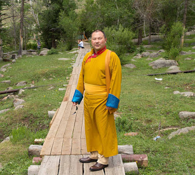

Telo Tulku Rinpoche
From this place, known as Khalteriin Ekh, we crossed 8907-foot Khökh Khamar Davaa (Blue Nose Pass). The rest of the afternoon we crossed a number of low passes separating the drainages of small, unnamed creeks before arriving in early evening at the Khökh Nuur, the bigger of the two lakes on the west side of Otgon Tenger. We had ridden 21.3 miles (34.3 km for you decimal heads) for the day, our longest ride of the trip, and I was exhausted. I had just gotten over a bad bout of pneumonia before coming on this trip, and I was still taking four different plant medicines I had gotten from Ganbaatar, a doctor of traditional Mongolian medicine at Manba Datsan. He had mentioned that they might make me weak, and this certainly seemed to be the case. We stopped at the ger of some friends of our horsemen and after eating a meal cooked on their stove I collapsed in my tent. (I will admit that I did manage to sneak in a few pages of The Self-Aware Universe: How Consciousness Creates the Material World before falling asleep.)
The next morning—the beginning of our last day on the Khora—the sky was a perfect dome of cobalt blue from horizon to horizon—the first morning without rain we had had on the trip. We had a leisurely breakfast and finally packed up and headed over the ridge to the west of Khökh Nuur. Climbing through a larch forest—the first real forest we had encountered on the trip, we finally arrived at Khoid Dayan Ovoo. From the Khoid Dayan Ovoo we continued on to Tsagaan Nuur, where Batbayar lives. We stopped at his ger for lunch and then continued on over a series of glacial moraines to the Children's Camp, where we had started.
The total distance of the Khora was 70.9 miles (114.1 km for you unrepentant decimal-heads) measured between twenty-five checkpoints, which we did in five days. We had prostrated to the mountain at the appropriate places, offering khadags (prayer scarves) and burned artz at the main ovoo, and I had repeated the Om Mani Padmi Hum mantra over 10,000 times while we were riding. Hopefully we had paid sufficient respect to the mountain. Whether our actions will have any beneficial effect on this and subsequent incarnations remains to be seen.

Statue of Ochirvani (Vajrapani), the Protector Deity of Otgon Tenger, which can be seen in the background. Several Kings of Shambhala are believed to be emanations of Ochirvani.

Ochirvani

Otgon Tenger Ovoo
Gazarchin Yooton at Otgon Tenger Ovoo

Otgon Tenger Ovoo

13,192-foot Otgon Tenger Uul
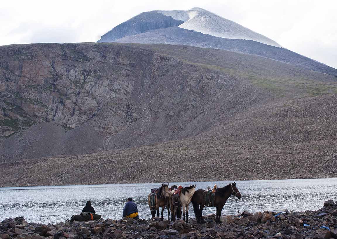
 Herdsmen at Övör Badarkhundaga Nuur, a glacial lake nestled in a cirque just below the south face of Otgon Tenger.

Herdsman praying at Övör Badarkhundaga Nuur
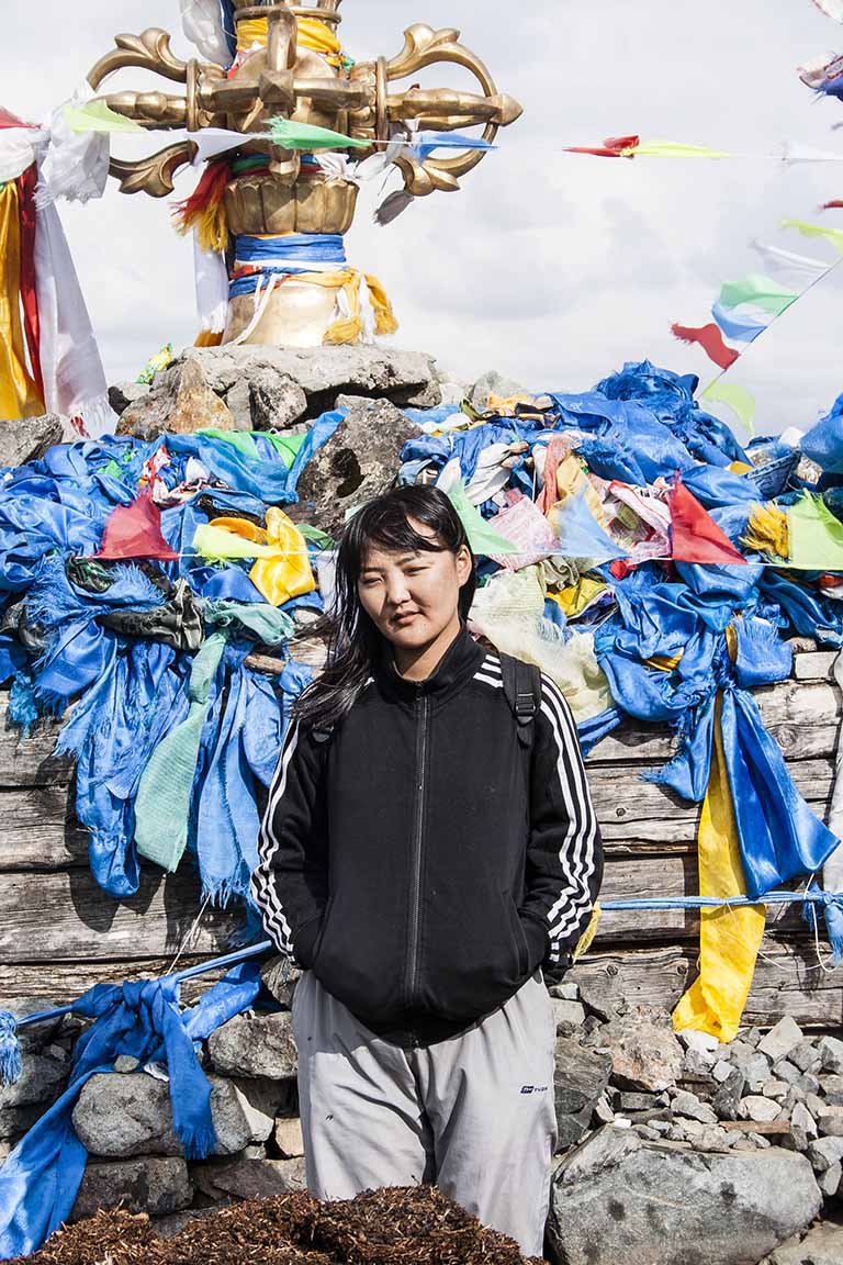
 Yootan at Övör Badarkhundaga Nuur


The legendary medicinal plant Vansemberuu found near Otgon Tenger.

Vansemberuu. There are any number of legends and Songs about this exceedingly rare plant. Another Song. The video of This Song uses my photos!