Turkey | Hasankeyf
Wandered by Hasankeyf, on the Tigris River about forty-six miles northeast of Mardin. As long as 3600 years ago a cave settlement was established here in the cliffs and ramparts bordering the Tigris River. It was later occupied by the Romans and turned into an important stronghold on the Roman-Parthian and later Roman-Persian border. In times of peace it served as a strategically located way-station on the Silk Road between the Orient and Occident. The headquarters of a Orthodox bishopric during early Byzantine times, it was conquered by the Arabs in the 640s and Islamized. The Mongols attacked and sacked the city in 1260. The details are unclear, but this assault on Hasankeyf may have been made by Mongol forces under the command of Kitbuqa Noyan. This Mongol army would later suffer a disastrous defeat at the hands of the Egyptian Mamluks in Palestine. In 1550 the city became part of the Ottoman Empire. It may not exist much longer. A dam now planned for the Tigris River will flood much of the area.
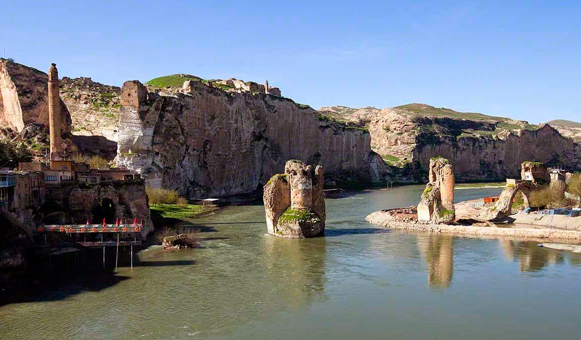
Remains of the bridge over the Tigris River built in 1116 by the Artuqid Sultan Fahrettin Karaaslan. Local guides claim the the supports of this bridge were build on the foundations of an earlier bridge built by the Romans. It was one of the largest bridges in the world in the twelfth century. The Citadel can be seen on the corner of the cliffs to the left. The pier-like structure extending from the left bank is the dining area of a restaurant which serves fish fresh from the Tigris River (click on photos for enlargements).

Ruins of one of the main bridge supports

The Citadel looming above the Tigris River

Ruins of ancient Hasankeyf

Cave residences
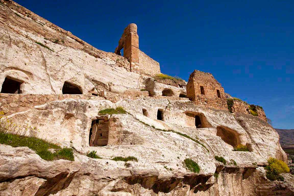
Cave residences and ruins

Pathway leading the top of the massif where the royal palaces and mosque are located.

Another view of the pathway leading the top of the massif where the royal palaces and mosque are located.

Cave dwellings

A view of modern-day Hasankeyf from near the top of the massif. The new town is inhabited by Kurds, Arabs, and Syriacs.

Another view from the top of the massif


Another view from the top of the massif where the royal palaces are located

The top of the main massif

Ruins of dwellings on the massif

Ruins of one of the royal places, reportedly built by the Ayyubids, descendants of the great Saladin, who conquered the area in the 1230s.

The Ulu Mosque, at the top of the main massif, was probably also built by the Ayyubids in the thirteenth or fourteen century.

Another view of the Ulu Mosque

Graveyard associated with the Ulu Mosque

Tombstone with the Ulu Mosque in the background

More tombstones
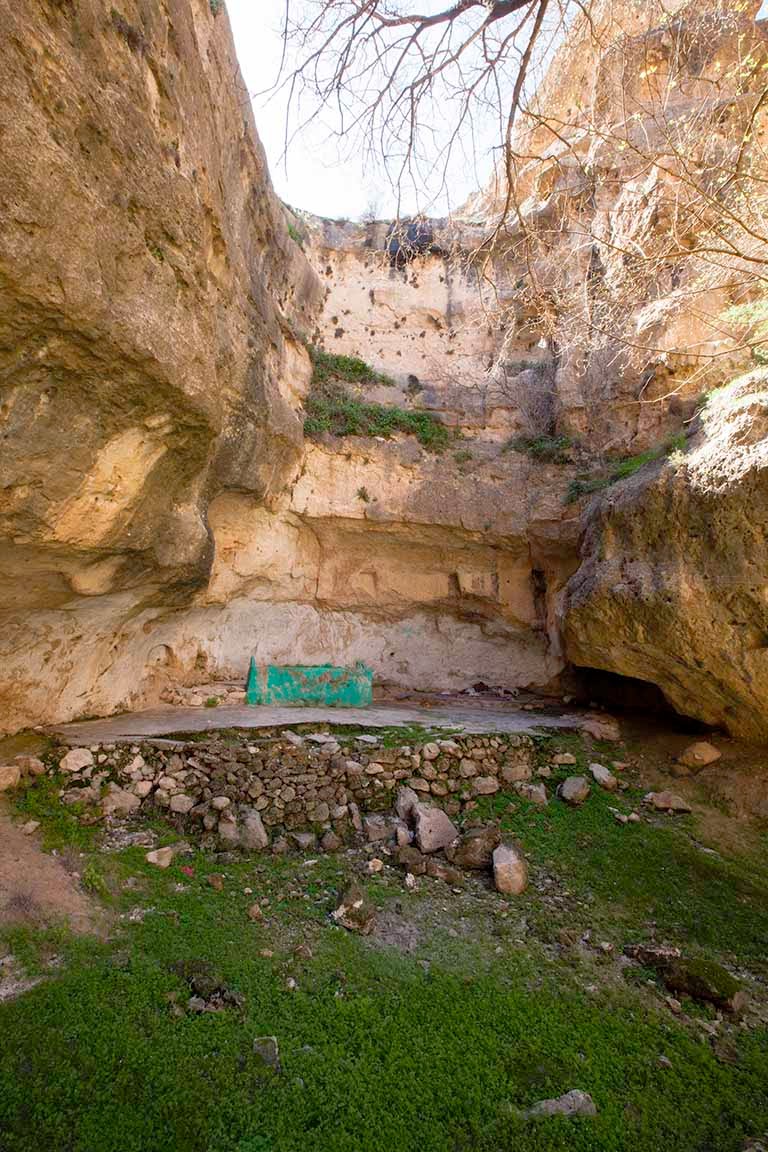
We descended from the massif and walked up the valley to a famous spring where people go to either meditate or indulge in Dionysian bacchanalias, depending on their inclinations.

The spring. I consider myself a cognoscente of drinking water and this water was excellent. It was not mineralized and icy cold, even though the air temperature was in the low 90ºs F.

A couple of miles from Hasankeyf is another smaller cave complex.

Cave dwellings

Cave dwellings

Just upstream from current-day Hasankeyf is the tomb of Zeynel Bey, ruler of the Hasankeyf area fron 1462 to 1482.

Current-day Hasankeyf is famous for its fish restaurants with fresh fish from the Tigris River. Many of the restaurants feature dining on barges in the river.

Relaxing on the dining barge in the Tigris river. Ancient cave dwellings can be seen on the far bank of the Tigris.
Information About The Dam which will flood much of the area if built.
Information About The Dam which will flood much of the area if built.